Saugeen River Canoe Route
Bruce County Road 17 to Bruce County Road 3
(paddle time 2hrs)
This is perhaps the most popular starting point for day tripping on the Saugeen River. A trip from
here lasts about four hours with time to stop for lunch. From the bridge, the river almost enters Port Elgin. Look for the town's water tower and other tall buildings before the river turns you back towards Southampton. A few very large forested islands sit along this section. About halfway through, Mill Creek empties into the Saugeen, making a hotspot for anglers. Near the end of this portion, the right bank rises to become a tree-lined cliff a kilometer so before the next bridge.

River Access
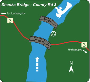
County Road #3 - Shanks Bridge
Location: Bruce County Road #3, just north of the flashing light at Burgoyne
Directions: Traveling north on Hwy# 9, take County Road #3 (Elora Road) turnoff just past the town of Mildmay. Follow County Road #3 through Paisley and past the flashing light of Burgoyne. 2km beyond Burgoyne is the bridge, set beside another old steel bridge. Turn right just before the bridge and park on the old road allowance.
Facilities: River access, parking.
Description: Access is 30m down a gentle slope to a low level shore.
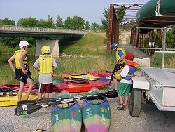
 Unloading at Shanks Bridge put in